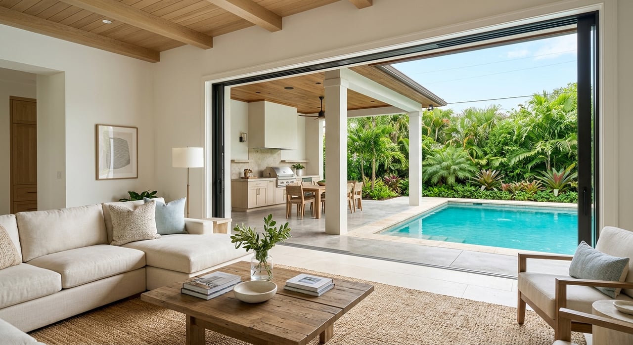
Are you picturing morning runs through calm canals and quick afternoons on open water, but not sure what “Gulf access” really guarantees? You are not alone. In North Naples and Vanderbilt Beach, the phrase can mean very different things for your daily boating and long-term value. This guide breaks down what to ask, what to verify, and how access type affects your lifestyle and resale. Let’s dive in.
Direct vs indirect Gulf access
Understanding the difference helps you match a property to your boat and plans.
- Direct Gulf access means you can reach the Gulf of Mexico without passing under low, fixed bridges or similar vertical obstructions that would block your boat’s normal air draft. You may still travel through canals and an inlet, such as Wiggins Pass.
- Indirect Gulf access means your route includes fixed bridges, longer inland waterways, or other constraints that limit certain boats. Sailboats and large sportfishing boats are often affected most.
- Air draft is the height of your boat above the waterline. Bridge vertical clearance is the space from the water surface to the underside of the bridge at a given tide or condition. Always confirm the tidal datum used when a clearance is quoted.
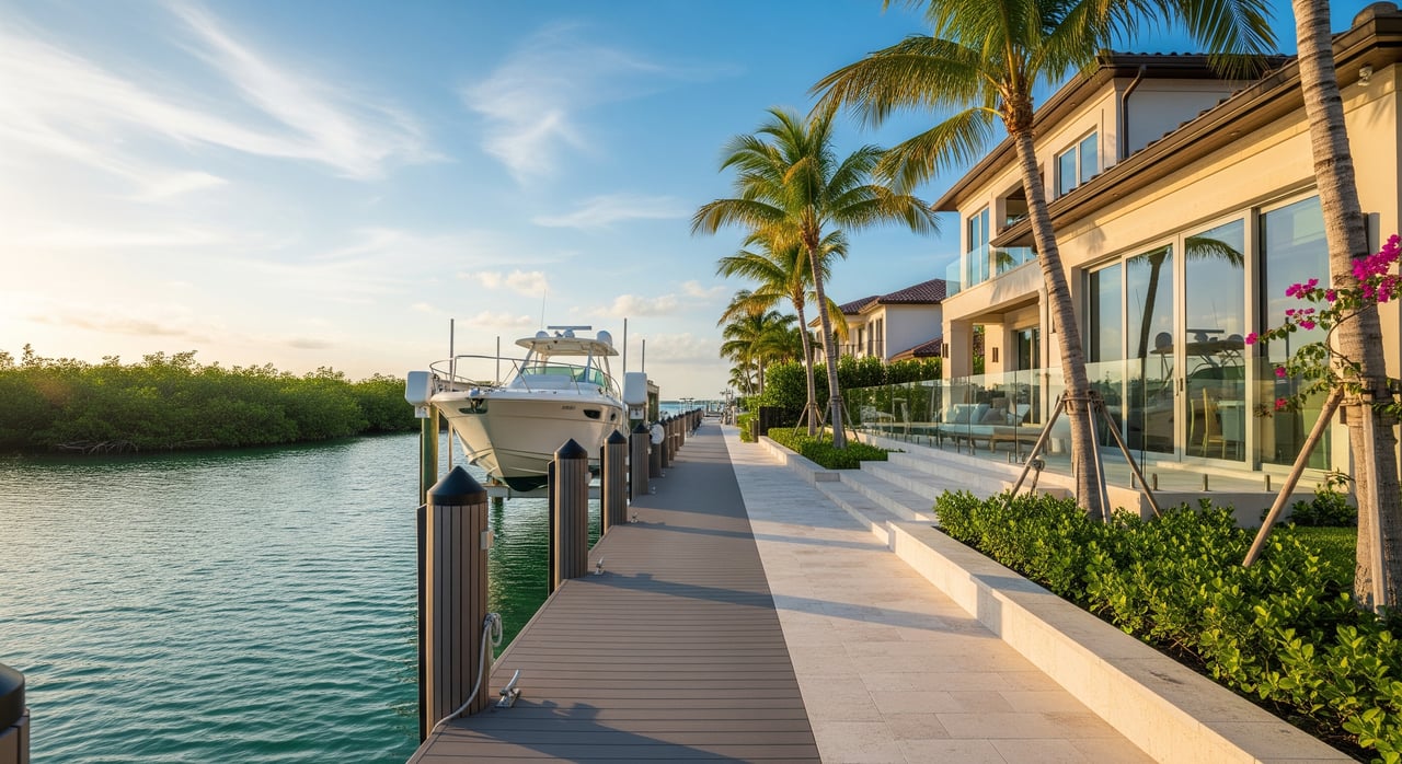
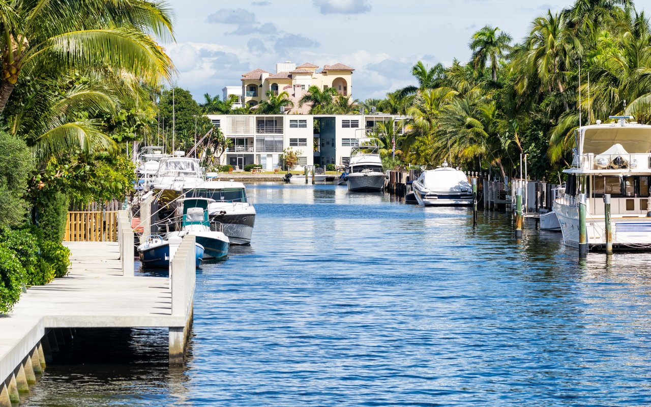
Vanderbilt Beach routes to the Gulf
Vanderbilt Beach and North Naples sit just inside Wiggins Pass. Many canal-front homes enjoy relatively short runs to the Gulf compared with more inland properties. Your specific “time to Gulf” depends on:
- Distance from your dock to the pass and the number of canal turns
- Posted speed limits and no-wake zones
- Traffic and congestion, especially on peak days
- Any fixed or movable bridges on your route
Use official nautical charts and local guidance to map your specific route to Wiggins Pass, then verify the factors that could slow you down.
Bridges and vertical clearance to check
Bridges are often the make-or-break detail for boat fit.
- Fixed bridges have a constant clearance that can limit taller vessels. Movable bridges open on schedule or on request, which can add delay but allow taller transits.
- Verify the exact vertical clearance at mean high water and confirm the datum. Know your boat’s air draft with antennas, hardtops, and outriggers accounted for.
- If a bridge is movable, confirm the opening schedule, notice requirements, and reliability through official bridge administration and transportation resources.
Trusted sources include state bridge inventories, U.S. Coast Guard bridge resources, and local county engineering offices.
Depth, shoaling, and tides
Depth controls whether your boat can move comfortably from dock to pass.
- Charted depths are shown relative to a tidal datum, often Mean Lower Low Water. Actual depth changes with tide and can change over time due to shoaling or dredging.
- Confirm controlling depths at your dock and along the route at low water. Recent soundings or local marina input can help.
- Inlets like Wiggins Pass can shoal and develop strong currents during peak ebb or flood. Many boaters time transits to avoid the strongest flows.
Consult nautical charts, local tide predictions, and notices to mariners for recent changes.
Speed zones and protected areas
Expect slow and no-wake zones across parts of the back-bay system. Seasonal manatee protection and other environmental zones are posted and enforced. These rules protect wildlife and shorelines and can extend transit time, especially on narrow or congested canals. Review county and state boating regulations for your route before you buy.
Time to Gulf: how to estimate
Every property and vessel is different. To build a realistic plan:
- Measure the water distance from the dock to Wiggins Pass using charts or marine GPS tools.
- Note posted speed or no-wake sections and estimate your average speed accordingly.
- Add time for maneuvering through narrow canals and turns.
- Account for any bridge openings or peak tidal currents at the pass.
In the Vanderbilt Beach area, many properties near Wiggins Pass offer shorter transits measured in tens of minutes rather than hours. Your exact time depends on your specific route and boat.
Lifestyle and daily use impacts
Access type shapes how you use your boat and how often you use it.
- Direct access with a short run to the pass supports spontaneous trips and frequent offshore runs.
- Indirect access that includes bridges or longer routes may be better suited to smaller powerboats, kayaks, and paddlecraft. Taller boats or sailboats may face limits or timing delays.
Choose based on your most frequent boating days, not only the rare longer excursion.
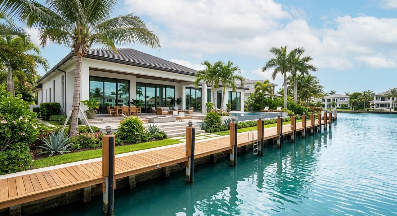
Maintenance, permitting, and insurance
Waterfront ownership requires attention to shoreline and compliance.
- Docks, lifts, and seawall work often need permits through Collier County and state or federal agencies. Keep records for future buyers.
- Private dredging is tightly regulated. Many owners rely on county or federal dredging projects when needed.
- Insurance can reflect vessel size, hurricane exposure, and local risk. Property flood zones from FEMA’s maps can influence both coverage and cost.
Documented maintenance and permits support value and smoother closings.
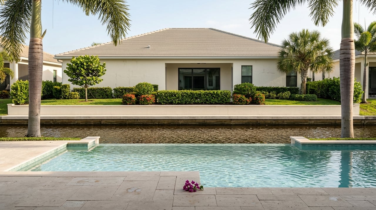
Market value and resale
Waterfront buyers compare access type, proximity to the pass, depth, and dock quality as closely as interior finishes.
- Reliable direct Gulf access often commands a premium versus similar homes with bridge limits or long inland runs.
- Two “direct access” homes can vary widely in value if dock length, lift capacity, seawall condition, or controlling depth differ.
- Providing clear documentation on access, bridge data, and dredging history can expand your buyer pool and reduce surprises during inspection.
Buyer due diligence checklist
Use this quick-reference list during showings and inspections:
- Route and bridges
- Map the route from dock to Wiggins Pass. Measure nautical miles.
- Identify all bridges. Get vertical clearance at mean high water and confirm the datum.
- If a bridge is movable, confirm opening schedule and procedures.
- Depth and draft
- Get recent soundings at the dock and along the route at low tide.
- Compare your boat’s draft to controlling depths and include under-keel clearance.
- Tides and currents
- Review local tide predictions for typical highs and lows.
- Ask marinas about current strength and best transit windows at Wiggins Pass.
- Regulations and environment
- Note posted speed and no-wake zones for your route.
- Confirm any seasonal manatee or protected-area restrictions.
- Shoreline and permits
- Inspect seawall condition. Collect permits for docks, lifts, and shoreline work.
- Ask about any past or planned dredging that affects your route.
- Insurance and flood
- Confirm FEMA flood zone and request quotes for wind and flood coverage.
- Local input
- Speak with nearby marinas or a harbormaster for real-world run times and shoaling updates.
Sellers: document your access advantage
Position your waterfront listing to stand out by packaging the details buyers value.
- Provide a simple route map to Wiggins Pass with distance and typical no-wake segments.
- List all bridges with type and vertical clearance plus the datum used.
- Share recent dock soundings, lift specs, and any permit records for docks, lifts, or seawall work.
- Summarize any recent dredging or maintenance activity that benefits your canal.
Clear, verified access data can boost buyer confidence and help protect your sale price.
Work with a local advisor
Choosing between direct and indirect Gulf access in Vanderbilt Beach is as much about lifestyle as it is about logistics. If you want help matching your boat and goals to the right canal and route, we are here to guide you. For confidential advice on specific properties, route verification, and a tailored plan for buying or selling, connect with Valarie Tillman.
FAQs
What does “direct Gulf access” mean for my boat in North Naples?
- It means you can reach the Gulf without passing under low, fixed bridges or similar obstructions that exceed your boat’s air draft, though you may still travel through canals and an inlet like Wiggins Pass.
How do I check if a bridge will block my vessel near Vanderbilt Beach?
- Identify each bridge on your route, confirm its vertical clearance at mean high water, match that to your boat’s air draft, and verify the datum used for both figures before you buy.
How can I estimate my time from a Vanderbilt Beach dock to Wiggins Pass?
- Measure water distance on charts, note no-wake zones, include any bridge openings, and allow for currents at the pass to create a realistic run-time for your specific boat.
What should I know about depth and shoaling around Wiggins Pass?
- Charted depths use a datum and can change with tide and shoaling. Get recent soundings at your dock and along the route, and ask local marinas about any recent changes.
Do speed and manatee zones affect daily boating in North Naples?
- Yes. Posted speed limits, no-wake areas, and seasonal wildlife protections are common and can extend transit times. Review county and state regulations for your route.
Will flood zone or shoreline condition affect my insurance on a canal home?
- Insurers consider FEMA flood zones, vessel risk, and shoreline integrity. Seawall condition, dock permits, and hurricane preparedness can influence coverage and pricing.